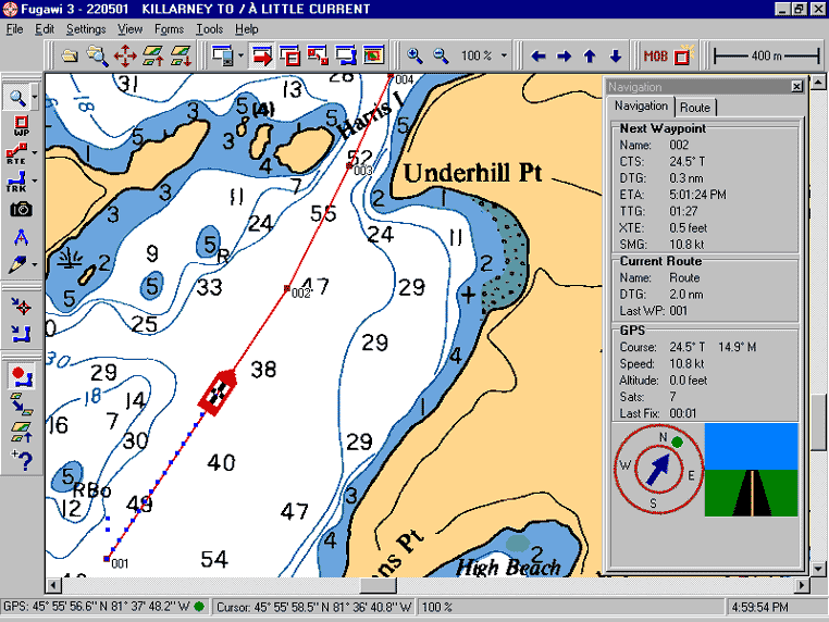
Heading Out To Sea
Marine Navigation with BSB or SoftChart Charts on CD
- With FUGAWI you can license a complete collection of electronic charts on a CD and have instant navigation.
- You will never have to worry about chart datum or map projections since you just set your GPS to WGS84 datum, load the Electronic Chart, and FUGAWI will do the rest.
- FUGAWI can send NMEA output to your radar or autopilot
-
Compatible with all BSB, SoftChart and Maptech chart and image products.
 |
Most NOAA marine charts for the United States are available in BSB and SoftChart formats. Canadian Hydrographic Service charts for Canada and official French nautical charts are now available in BSB format. Other areas covered include the Baltic and the Adriatic. |